GPS Fish Finders for Big Lake Fishing
There's nothing quite as frustrating as heading out onto a vast body of water, full of hope, only to feel completely overwhelmed by its sheer size. You know the fish are out there somewhere, but finding them in a massive lake, especially one you don't fish regularly, can feel like searching for a needle in a haystack. This guide is all about cutting through that frustration and equipping you with the knowledge to make those big Illinois lakes feel a little smaller and a lot more productive, focusing on how GPS fish finders become your ultimate angling ally.
Why GPS Fish Finders Are a Game-Changer for Big Water
When you're staring out across the expanse of Lake Michigan, or trying to pinpoint a specific structure on the seemingly endless waters of Carlyle Lake or Lake Shelbyville, the traditional methods of just 'drifting and hoping' quickly fall short. Big lakes present big challenges, but modern GPS fish finders are designed precisely to overcome them, transforming a daunting fishing trip into a targeted, efficient hunt.
Overcoming the Vastness of Large Lakes
Think about trying to consistently find a submerged hummock the size of a small car in a lake covering thousands of acres. Without precise navigation, it's virtually impossible. This is where the GPS functionality of your fish finder truly shines. It’s not just about showing you where you are; it's about remembering where you were and where you want to be. Every productive cast, every school of baitfish, every subtle depth change you discover can be marked with a waypoint.
Imagine you're trolling across a vast flat on Lake Shelbyville. Suddenly, your rod bends, and you land a nice walleye. In a traditional setup, you might mark the general area with a buoy, but the wind and current will quickly move you off that exact spot. With a GPS fish finder, you hit a button, a digital pin drops on your screen, and you have the exact coordinates saved. Now, you can run back to that precise location, make another pass, and potentially hit that school of fish again. This kind of accuracy turns a lucky catch into a repeatable pattern, making vast waters manageable and your fishing trips much more consistent, especially when you're targeting species that relate to specific underwater features.
Beyond Just Locating Fish: Mapping the Depths
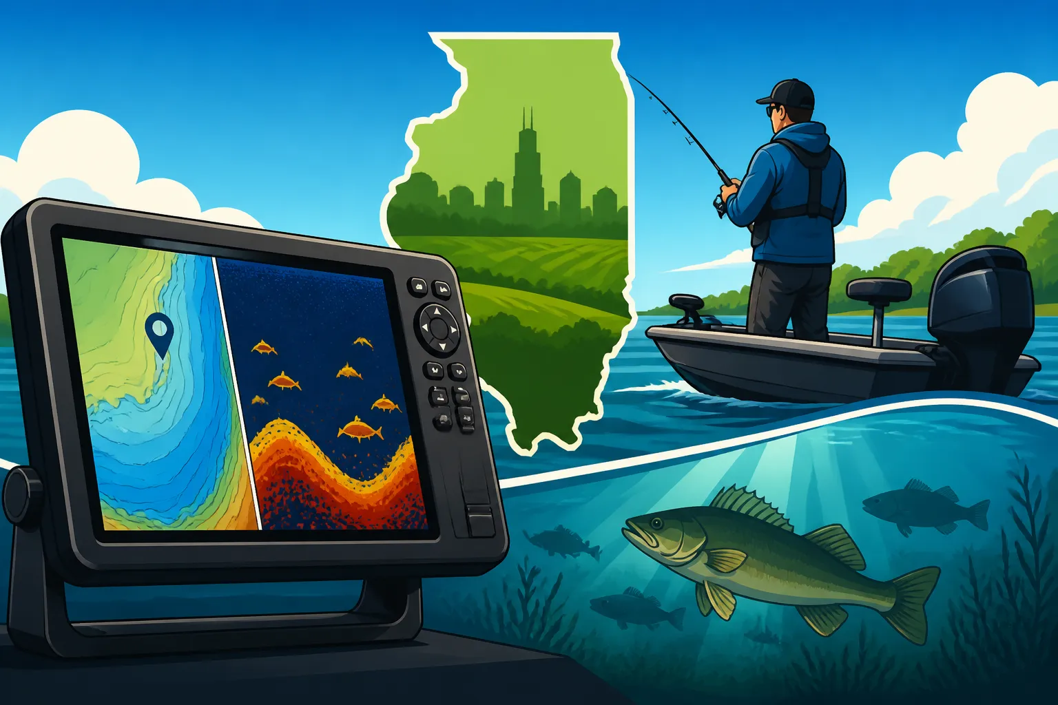
While seeing a fish arch on your screen is certainly exciting, a modern GPS fish finder does so much more. These aren't just fish-detecting gadgets; they are sophisticated mapping tools that reveal the underwater world in stunning detail. For big lakes, understanding the bottom topography is often even more critical than just seeing individual fish.
These units display intricate contour lines, showing you subtle changes in depth, steep drop-offs, underwater points, humps, and even old creek channels that were there before the lake was flooded. This is crucial intel for any serious angler. For example, largemouth bass might stage on a deep ledge adjacent to a shallow flat, while crappie could be suspended in a submerged timber stand along an old riverbed. Walleye often patrol rocky points or humps. Your fish finder allows you to interpret these features, understanding why fish would be there, rather than just if they are there. This geological understanding of the lakebed gives you an enormous advantage. You can spend less time randomly searching and more time precisely targeting areas that naturally hold fish. It’s like having a detailed topographic map of an alien landscape, giving you all the clues you need to unlock the lake's secrets.
Key Features to Look for in a Big Lake GPS Fish Finder
Choosing the right GPS fish finder for big lake fishing is a bit like selecting the perfect tool for a specialized job – you want something robust, reliable, and packed with features that genuinely enhance your experience. For large, open waters, certain capabilities become non-negotiable, moving beyond basic fish detection to advanced underwater reconnaissance.
Screen Size, Resolution, and Display Quality
When you're out on the wide-open waters of Lake Michigan or running across the expansive Carlyle Lake, glancing at a tiny, low-resolution screen is simply impractical and frustrating. For big lake fishing, screen size truly matters. You'll often want to split your screen to view multiple functions simultaneously – maybe a detailed map on one side and a high-definition sonar view on the other. A larger screen, say 9 inches or more, provides the real estate needed to make sense of all that information without squinting.
Resolution, measured in pixels, dictates the clarity and detail of the image. Higher resolution means crisper images, better definition of individual fish, and more discernible details in your mapping and sonar returns. Furthermore, consider the display quality in direct sunlight. Many units now feature bright, anti-glare screens that remain visible even on the sunniest Illinois summer days. Color palettes are also important; a unit with a wide range of vibrant colors helps distinguish different sonar returns, making it easier to separate fish from structure or identify various bottom compositions. This visual clarity directly translates to better decision-making on the water.
Advanced Sonar Technologies (CHIRP, Side/Down Imaging)
Gone are the days when a simple 2D sonar was all you had. Modern GPS fish finders for big lakes integrate several powerful sonar technologies that paint a much more complete picture of the underwater world.
- CHIRP Sonar: This is a fundamental improvement over traditional 2D sonar. Instead of sending out a single frequency pulse, CHIRP (Compressed High-Intensity Radiated Pulse) sends a continuous sweep of frequencies. The result? Much clearer, more defined fish arches, better target separation (meaning you can distinguish individual fish in a school), and improved depth penetration. For example, if you're trying to identify baitfish schools or distinguish a suspended walleye from a nearby branch on Rend Lake, CHIRP makes a significant difference.
- Down Imaging (or DownVu/Mega Down Imaging): This technology provides a photo-like view directly beneath your boat. It excels at showing you what's on the bottom with incredible detail – individual rocks, stumps, brush piles, and even fish relating tightly to that structure. It’s like looking straight down with a high-definition camera. When you're investigating a specific piece of structure, like a submerged bridge footing or a rock pile, Down Imaging reveals its true nature.
- Side Imaging (or SideVu/Mega Side Imaging): Perhaps the most revolutionary for big lake exploration, Side Imaging allows you to scan wide areas to either side of your boat. Instead of just a narrow cone directly below, you can see out to 100 feet or more on each side. This is an absolute game-changer for finding structure or schools of fish quickly. Imagine slowly idling over a vast, featureless flat on Lake of Egypt, and suddenly, your Side Imaging screen reveals a perfectly hidden brush pile to your left, complete with a school of crappie holding tight to it. You would have likely passed right over it with traditional sonar. Side Imaging helps you cover massive amounts of water efficiently, pinpointing those elusive sweet spots that might otherwise go unnoticed. Brands like Garmin, Lowrance, and Humminbird all offer their versions of these advanced imaging technologies, each with their own unique strengths.
Mapping Capabilities and Lake Charts
A GPS fish finder is only as good as its maps, especially when you're navigating and fishing big lakes. The internal mapping capabilities and the quality of the lake charts are paramount.
Many units come with pre-loaded maps covering major lakes, often including basic depth contours. However, for serious big lake angling, you'll want to invest in high-definition, detailed contour maps. These premium maps, often from third-party providers or the fish finder manufacturer itself (e.g., LakeMaster for Humminbird, Navionics or C-MAP for Lowrance/Garmin), provide incredibly accurate, 1-foot contour lines. This level of detail allows you to precisely identify subtle breaks, humps, and points that might hold fish. For bodies of water like Lake Shelbyville, where fish often relate to precise depth changes, these detailed maps are invaluable.
Some advanced units even offer custom mapping features, allowing you to create your own high-definition maps in real-time as you motor across the lake, filling in details that might be missing from existing charts. This is fantastic for exploring newly flooded areas or obscure parts of a lake. Whether it's finding the perfect trolling run for Lake Michigan Salmon and Trout Fishing in Illinois or navigating safely through submerged timber, superior mapping is a non-negotiable feature for big water.
Practical Application and Maximizing Your GPS Fish Finder on Illinois's Big Lakes
Having a powerful GPS fish finder is one thing; knowing how to leverage its capabilities to consistently catch fish on vast Illinois lakes is another. It's about translating those impressive on-screen images and data points into actionable fishing strategies.
Marking and Revisiting Hot Spots
One of the most immediate and profound benefits of a GPS fish finder on big water is the ability to mark and revisit specific locations with incredible accuracy. Think about a scenario on Clinton Lake: you're drifting, and your sonar suddenly lights up with a school of bass around a submerged stump field. You hook one, land it, and instinctively want to get back to that exact spot.
Here's how it typically works:
- Spot a Feature or Fish: As soon as you see something promising on your sonar (a fish school, a brush pile, a sharp depth change) or get a bite, hit the 'Mark Waypoint' button on your unit.
- Name and Icon: Give the waypoint a descriptive name (e.g., "Bass Stump," "Crappie Brush Pile") and assign it an appropriate icon. Many units allow you to customize these.
- Navigate Back: If you drift away, simply select that waypoint on your map, and your GPS will guide you straight back to it, often with an on-screen arrow or a breadcrumb trail. This is a game-changer compared to trying to line up distant landmarks or dropping a buoy that then drifts. You can literally make a U-turn and be within feet of your original spot.
This precision is invaluable on lakes where fish relate to very specific, often small, pieces of structure. Whether it's a isolated rock pile on Lake of Egypt or a subtle contour break on Rend Lake, being able to return to it again and again, even days or weeks later, builds a comprehensive mental map of the lake's productive areas. It turns transient luck into reproducible success. Anglers targeting species like crappie or walleye, which often school tightly around specific structures, will find this feature particularly useful, turning an unknown water into a familiar fishing hole over time. You can learn more about finding those specific spots in our Best Walleye Fishing Spots in Illinois guide.
Understanding Contours and Structure for Target Species
The detailed contour maps displayed on your GPS fish finder aren't just pretty lines; they are blueprints to fish behavior. Learning to interpret these lines in conjunction with your sonar returns will elevate your big lake fishing skills significantly.
- Drops and Ledges: Look for areas where contour lines are tightly packed, indicating a steep drop-off. These are often highways for fish, offering quick access to different depths and ambush points. Bass and walleye frequently patrol these edges.
- Humps and Points: Underwater humps and points that extend out into deeper water are classic fish magnets. They concentrate baitfish and provide cover for predators. Your fish finder's mapping will show these clearly, and your imaging sonar will reveal any fish holding to them.
- Submerged Timber and Brush Piles: On many Illinois lakes, especially man-made reservoirs, vast amounts of standing timber or intentionally sunk brush piles exist. These are crappie and bass havens. Down and Side Imaging are exceptional at locating these underwater forests and showing you if fish are present. Imagine finding a giant oak tree lying on its side on the bottom of Kinkaid Lake, and your Down Imaging shows dozens of crappie suspended within its branches. That's a spot you'll want to mark!
By understanding how different species relate to specific structures, you can use your GPS fish finder to actively hunt for these conditions. Instead of covering miles of unproductive water, you can target specific depths, transitions, and structures that are known to hold your desired fish. Our guide on Largemouth Bass Fishing in Illinois: The Complete Guide offers more insights into their habitat preferences.
Integrating with Trolling Motors and Networking Systems
For anglers serious about big lake fishing, the integration capabilities of modern GPS fish finders can be a game-changer, especially for boat control and covering large areas.
Many high-end fish finders can communicate directly with electric trolling motors from the same brand (e.g., a Humminbird unit with a Minn Kota i-Pilot Link, or a Lowrance with a MotorGuide Xi5). This allows you to control your trolling motor directly from your fish finder screen. You can tell your trolling motor to follow a specific contour line, hold your boat over a marked waypoint, or even navigate a pre-set route. This hands-free boat control is invaluable when fishing solo or when you need to focus on casting and fighting fish, especially in windy conditions on wide-open water. Imagine auto-piloting your boat along a deep channel edge on the Mississippi River while you focus on jigging for Illinois Walleye Fishing: The Complete Guide.
Furthermore, for larger boats or those with multiple fishing stations, networking systems allow you to link several fish finder units together. This means you can view sonar from a transom-mounted transducer on your bow unit, share waypoints and routes between consoles, and even view engine data or radar on your fish finder screen. This integrated approach creates a highly efficient and comprehensive command center for big lake fishing, ensuring all your critical information is accessible wherever you need it on the boat.
| Feature | Basic GPS Fish Finder (Good for Small Lakes) | Advanced GPS Fish Finder (Ideal for Big Lakes) |
|---|---|---|
| Screen Size | 5-7 inches | 9 inches and larger |
| Resolution | Moderate (e.g., 480×480) | High (e.g., 800×480 or higher) |
| Sonar Type | Standard 2D sonar | CHIRP 2D, Down Imaging, Side Imaging |
| Mapping Detail | Basic contours, limited pre-loaded | 1-foot contours, premium charts, custom mapping |
| GPS Accuracy | Standard GPS | High-precision GPS with faster refresh |
| Connectivity | Limited (standalone) | NMEA 2000, Ethernet (for networking) |
| Trolling Motor Integration | None | Full integration with compatible motors |
| Waypoint Storage | Several hundred | Thousands of waypoints and routes |
Choosing and Acquiring Your GPS Fish Finder
The final step is turning your informed decision into a tangible piece of gear on your boat. With so many options out there, it can feel like a labyrinth, but knowing where to look and what to expect in terms of cost and support will make the process much smoother.
Budgeting for a Big Lake Unit
GPS fish finders, especially those with advanced features suitable for big lake fishing, represent a significant investment. You'll find a wide spectrum of costs, and generally, more features, larger screens, and higher performance correlate with a higher price tag.
Entry-level units with basic GPS and 2D sonar might be on the lower end of the cost scale. However, for the depth and detail required for expansive waters, you'll likely be looking at units that incorporate CHIRP, Down Imaging, and Side Imaging, along with detailed mapping capabilities. These units typically fall into a mid-to-high price range. Top-tier models, often with massive screens, hyper-realistic imaging, and extensive networking options, will be at the very top of the range.
It's important to consider your personal fishing style and the specific lakes you frequent. If you primarily fish smaller impoundments and only occasionally venture onto a large lake, you might be able to get by with a more mid-range unit. But if you're regularly tackling the vastness of places like Lake Shelbyville, Carlyle Lake, or Lake Michigan, investing in a more robust system will pay dividends in terms of efficiency and success. Think of it as investing in an essential piece of equipment that will enhance every big lake trip you take.
Where to Buy and Get Support
Once you've narrowed down your choices, you have several avenues for purchasing your new GPS fish finder. Each offers distinct advantages.
- Local Tackle Shops: Don't underestimate the value of your local independent tackle shop. These places are often run by passionate anglers who have firsthand experience with many of the units they sell. They can offer personalized advice, help you understand the nuances of different models, and sometimes even assist with installation tips specific to your boat. While they might not always have the absolute lowest prices, the expert advice and customer service can be invaluable.
- Major Retailers: Big box sporting goods stores like Bass Pro Shops offer a massive selection of fish finders from all the major manufacturers. You can often see multiple units side-by-side, compare features, and speak with staff who specialize in marine electronics. Bass Pro Shops also frequently runs sales, so keeping an eye on their flyers can net you a good deal. Their showrooms allow you to physically interact with the units, which is a big plus when deciding on screen size and interface.
- Online Retailers: Websites like Amazon provide an incredible selection, often with competitive pricing and detailed customer reviews. This can be a great option for research and comparing specific models. Amazon's convenience and wide inventory mean you can often find exactly what you're looking for, sometimes with quick shipping directly to your door. When buying online, ensure you're purchasing from an authorized dealer to guarantee warranty coverage and legitimate products.
Regardless of where you purchase, always consider the warranty and customer service offered by the manufacturer. Marine electronics are complex, and having good support can save you a lot of headaches down the line. Reading reviews and understanding common issues (and how the company handles them) can be a wise move before making your final decision. The right GPS fish finder isn't just a gadget; it's an investment in countless more productive and enjoyable days on Illinois's magnificent big lakes.
Disclaimer
This article is for general informational purposes only and does not constitute professional advice. Laws, prices and regulations vary by location and change over time. Consult a qualified professional for guidance on your specific situation.